Invasion Day 412 – Summary
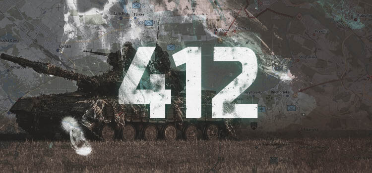
The summary of the situation of Russian re-invasion to Ukraine covering the last 48 hours, as of 11th April 2023 – 22:00 (Kyiv time).
Sloboda Front
includes the area of between Oskil and Aydar river
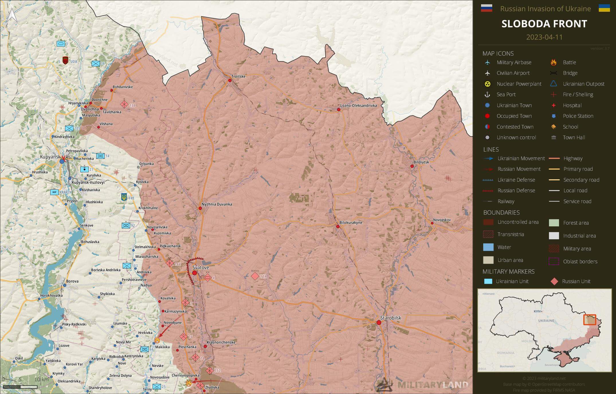
Ukrainian General Staff reports repelled attacks in the vicinity of:
- No activity reported.
Siverskyi Donets
overview map of Slovyansk, Kramatorsk, Bakhmut and Lysychansk vicinity
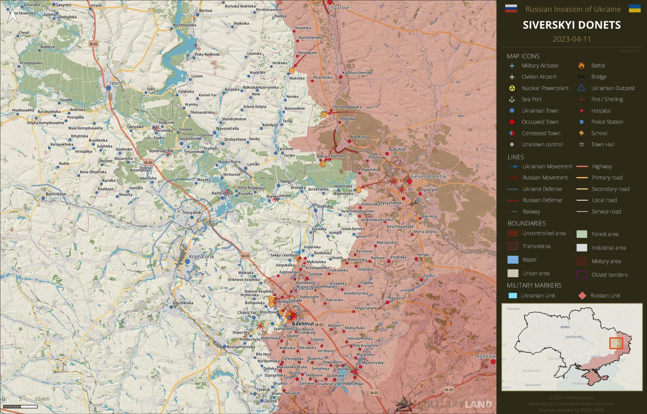
- Soldiers of Ukrainian 30th Mechanized Brigade assaulted Russian positions in the vicinity of Sakko i Ventsetti settlement. However, the video also shows that Russians control more territory in the area than we previously knew about. (source)
Ukrainian General Staff reports repelled attacks in the vicinity of:
- Makiivka, Chervonopopivka, Dibrova, Bilohorivka, Spirne
Bakhmut Front
includes the vicinity of Bakhmut
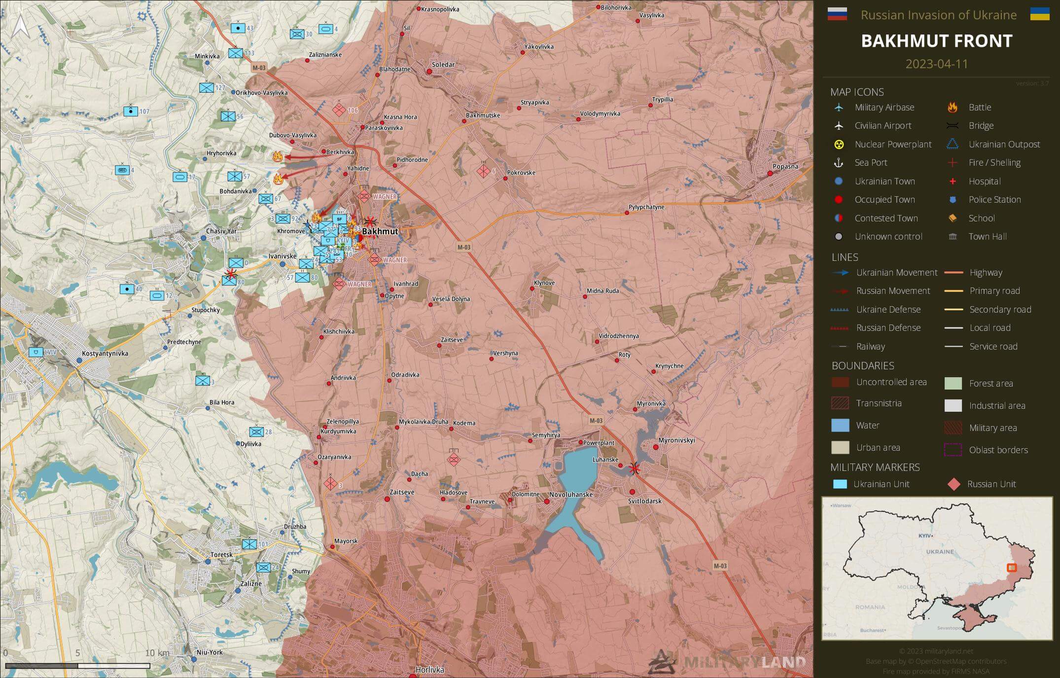
Ukrainian General Staff reports repelled attacks in the vicinity of:
- Hryhorivka, Bohdanivka, Khromove, Bakhmut
Bakhmut City
the city of Bakhmut
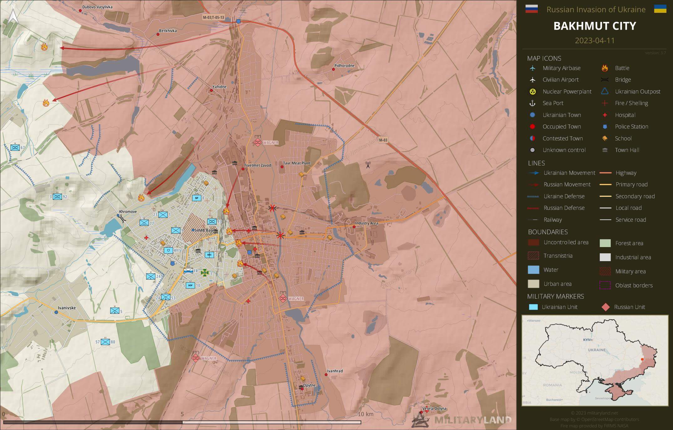
- Ukrainian suicide drone targeted Russian infantry north-west of Khromove. (source)
- Russians released a video confirmation that Wagner mercenaries captured Metalurh Stadium in the central part of Bakhmut. (source)
- Fighting has moved to the vicinity of the main train station. (source)
Avdiivka Front
includes the vicinity of Avdiivka
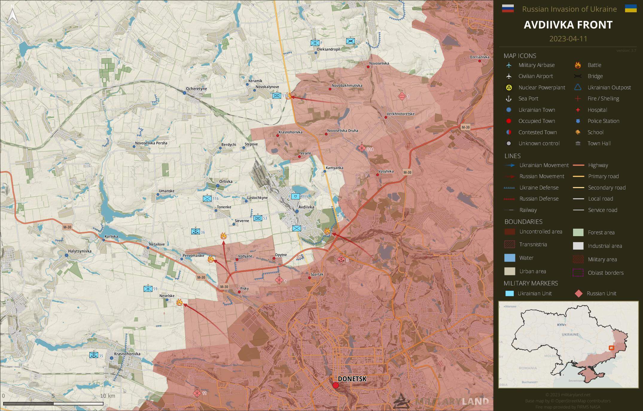
- The enemy managed to advance west of Novobakhmutivka and reached the nearby H20 road. They also captured Ukrainian fortified positions nearby. (source)
Ukrainian General Staff reports repelled attacks in the vicinity of:
- Novokalynove, Berdychi, Avdiivka, Sieverne, Vodyane, Nevelske
Donetsk Front
includes the center and southern part of Donetsk Oblast
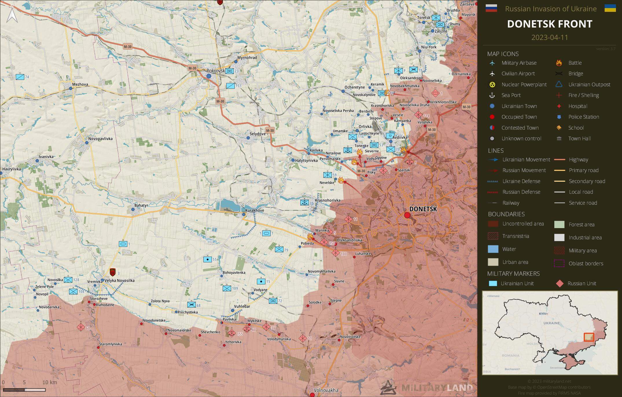
Ukrainian General Staff reports repelled attacks in the vicinity of:
- Marinka
Zaporizhzhia Front
includes the Zaporizhzhia Oblast
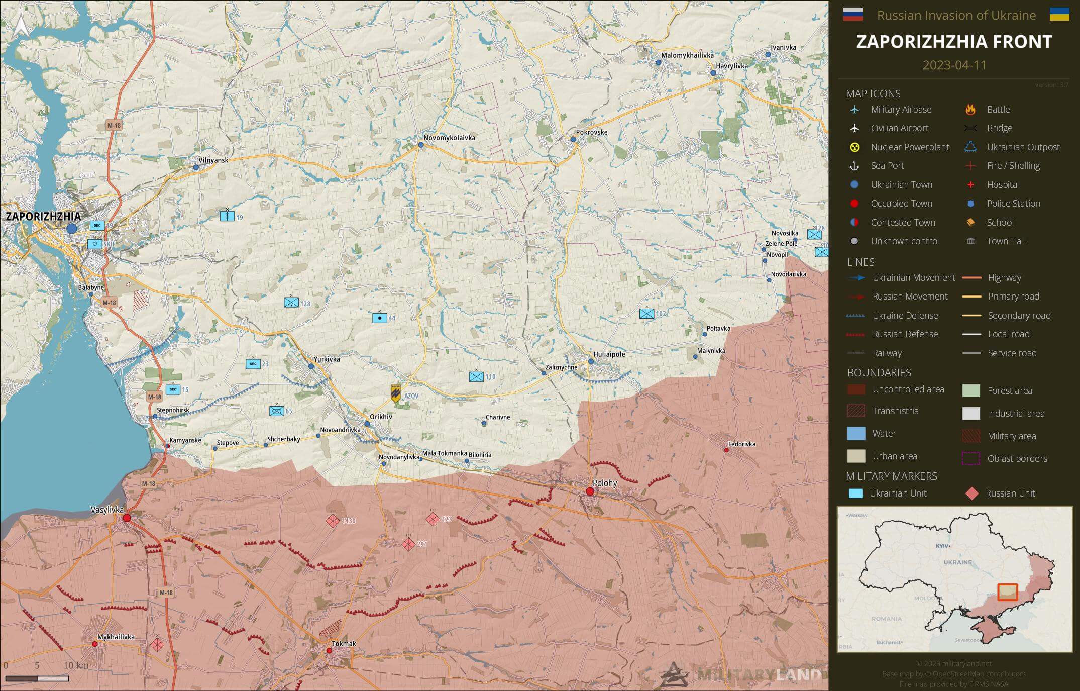
- Russian army targeted Ukrainian positions south of Huliaipole. (source)
Ukrainian General Staff reports repelled attacks in the vicinity of:
- No activity reported.
Kalanchak Front
includes the left bank of Dnipro river south of Kherson and Kakhovka
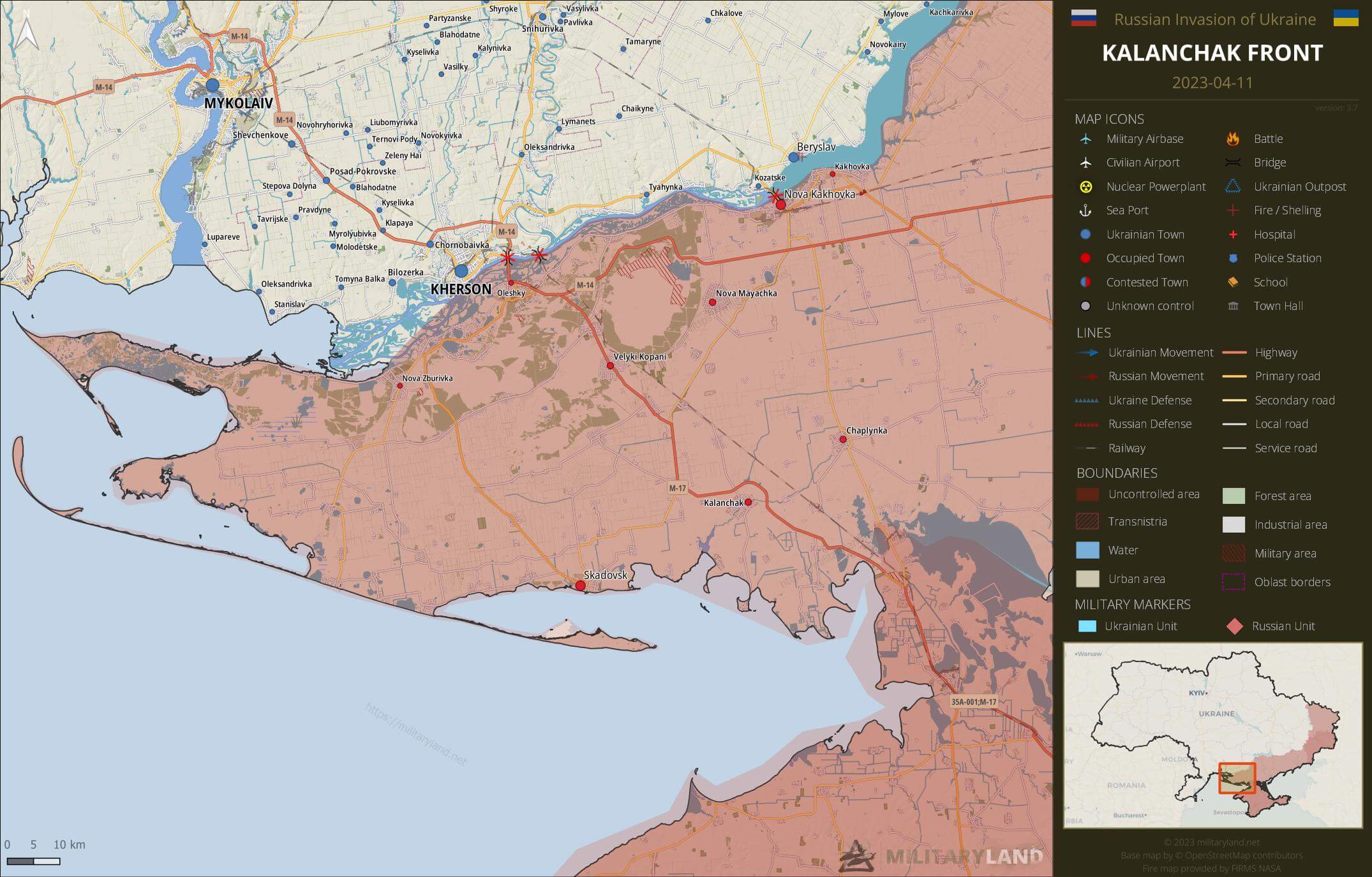
- No change on the ground during the past 48 hours.
Full map
The full overview map of current situation.

Looking for an interactive map? We got you covered. Visit our original Deployment map.
If you would like to use our maps in your project, video or any other media, please visit Invasion maps page for more information.
This summary and detailed maps are based on the following sources:
General Staff of the Armed Forces of Ukraine, official media channels of Ukrainian regional administrations, Ukrainian Ministry of Internal Affairs, Security Service of Ukraine (SBU) and geolocated footage.
We also thank the following Twitter users for their geolocations and amazing work: @neonhandrail, @auditor_ya and the team at @geoconfirmed.
If you enjoy this content, the best way to support our site is by sharing it and following us on X, Bluesky and Facebook.
Topics:
Related posts
Our community
Mentioned Units
No unit mentioned.Support us
seems that there is no miracle to expect …slowly advance the agressor and west support decrease.
West support decrease? Where?
Come back in summer, then we will know.
WinterSummer is coming for RussiaHe didn’t say what year it will winter 🙂 May be 2025
Western support is not falling. It has a tendency to increase. Pakistan is sending several large containers with ammunition, South Korea has decided to deliver ammunition indirectly via third countries (USA). Georgia, Kazakhstan and other former CIS countries are now sending arms to Ukraine. Six months ago it was unthinkable that these countries would participate in arms deliveries.
But Russia has also done a lot to ensure that many neutral countries are now slowly turning to Ukraine because of the horrific war crimes that have been made public. If you don’t have your army under control, you don’t need to expect help.
What’s wrong with the Ukrainian 110th Mechanized Infantry Brigade? They lost their positions!
If you mean they lost their positions near Novobakhmutivka, yeah, they did (probably at least a few days ago).
If you are referring to their position on Jerome’s map, please keep in mind that the unit icons just give you a general idea where the unit is deployed, not their exact location (which shall not be given because of OPSEC).
A fixed position is lost only if the opponent takes, holds and secures that position.
The Ukrainians certainly gave up the position to retreat to a better position.
That is why it is so difficult for the Russians to capture cities. Because they neglect to secure them, or they don’t have the people to do it. The Ukrainians then recapture these positions again and again.
Exactly… it will be exactly the same with Bakhmut… attracting them further in city while retreating to extend their lines and disperse them…Russian never holds positions.. they push forward without securizing … it is the best strategy in urban warfare when you know that the city itself is completely destroyed into dust … then artillery will hit them while UKR troops retreats
The Russians bombard the city until there are probably no defensive positions left. This strategy worked in Aleppo and Grozny. But the Ukrainians are clever. They bury themselves like moles and hide like cats.
Of course, it works wonderfully with the Russians, because they have drunk their brains. They try to take the same way ten times without success and the eleventh time is not better.
Ten months ago you assured that Russia had already lost the war that it was only a matter of weeks for Ukraine to recover 100×100 of its territory, now that Russia is the second best army in the world but it is pathetic
If you look at the whole thing from the point of view of Russian understanding, then Russia already lost this war when leaving Kiev. So far, almost nothing has been successfully completed that was planned at the time of the invasion
A country full of fascists cannot win by trying to denazify another country.
Russia is pathetic. A bunch of war criminals and sore losers, unable to win the war so they behead prisonners.
And those who cheer for Russia are not better.
So drunkards and losers fight the elite of the Ukrainians in Bakhmut and they haven’t collapsed yet. What does this so for Ukraine? It’s so easy to extract silly conclusions with silly statements.
So drunkards and losers spent tens of thousands of men to try to take Bakhmut, and they still haven’t take it yet after 10 months of attacks.
And what is even more pathetic ? Bakhmut is where Russians got their best results. Everywhere else, they suffered every casualties for little to no gain at all.