Invasion Day 272 – Summary
The summary of the situation of Russian re-invasion to Ukraine covering the last 48 hours, as of 22nd November 2022 – 22:00 (Kyiv time).
Briefly:
The vicinity of Bakhmut remains the hottest point, but Russian forces are unable to gain a momentum here, or anywhere else.
Snow covered most parts of Ukraine, turned fields and dirt roads into a mud, which denies any larger military operation.
Sloboda Front
includes the area of between Oskil and Aydar river
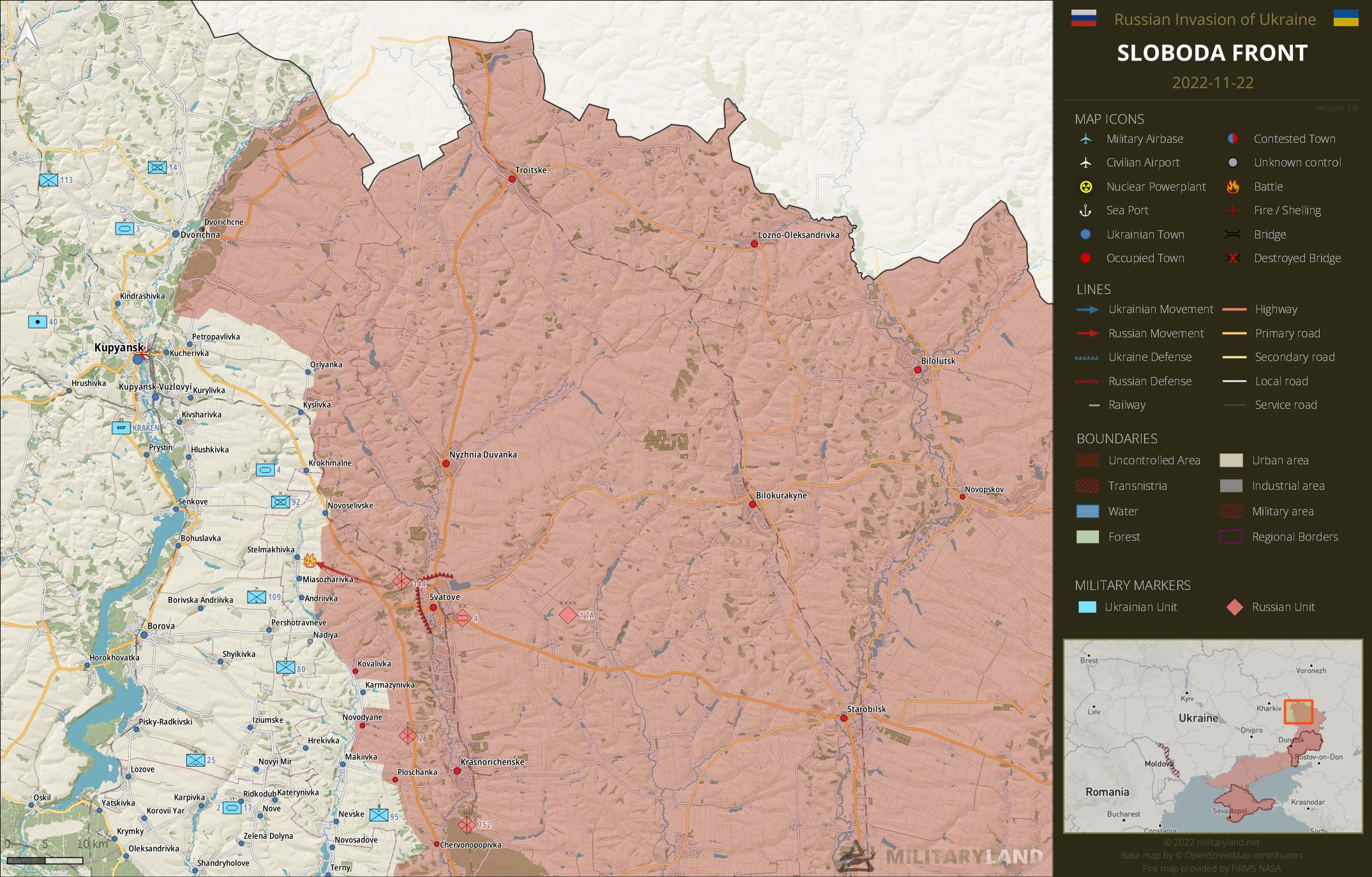
Svatove direction
- The enemy conducted a recon by force near Stelmakhivka settlement.
Bakhmut Front
includes the vicinity of Bakhmut
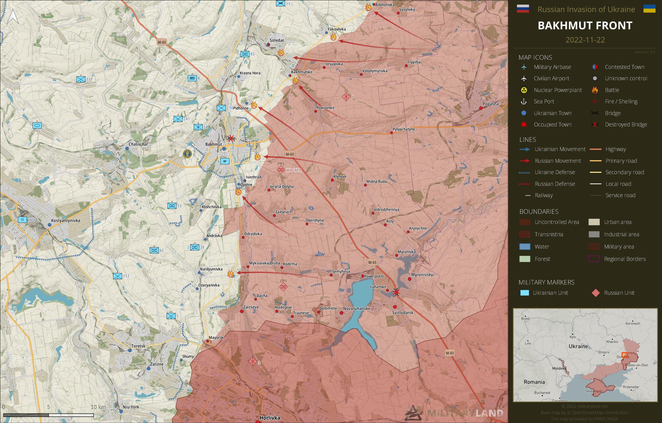
- Ukrainian defenders repelled a Russian attack towards Yakovlivka.
- Russian forces attacked Ukrainian positions near Pidhorne in the attempt to encircle Bakhmut from the north-east. The defenders repulsed the assault.
- Fighting continues in the vicinity of Soledar and Bakhmut.
- The enemy attempted to break through Ukrainian lines near Opytne and Kurdyumivka, both attempts were neutralized.
Siverskyi Donets
overview map of Slovyansk, Kramatorsk, Bakhmut and Lysychansk vicinity
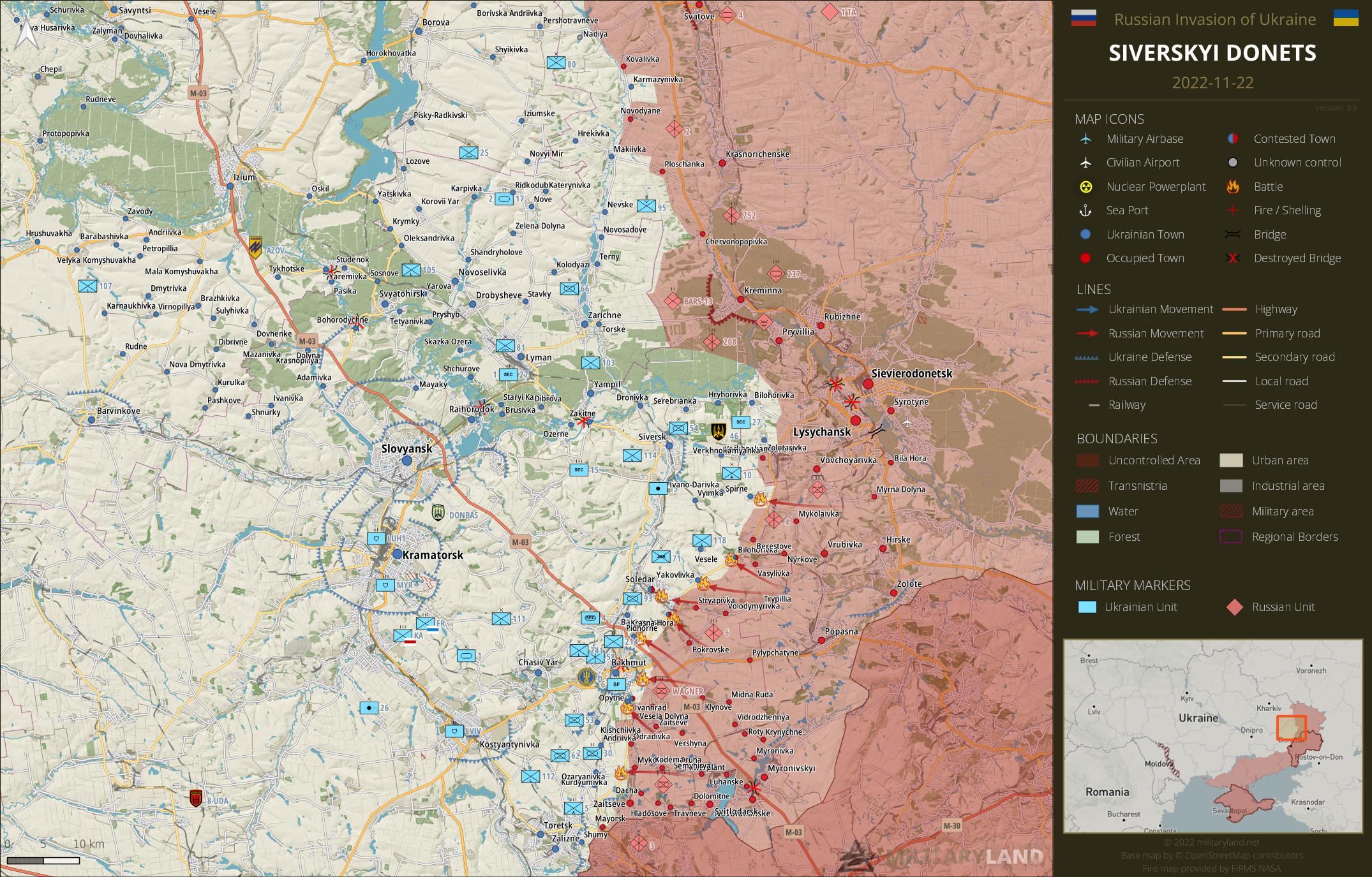
Lysychansk direction
- Russian troops tried to seize new positions near Bilohorivka (Donetsk Oblast), but they weren’t successful.
- Ukrainian defenders managed to repel another attack in the direction of Spirne settlement.
Avdiivka Front
includes the vicinity of Avdiivka
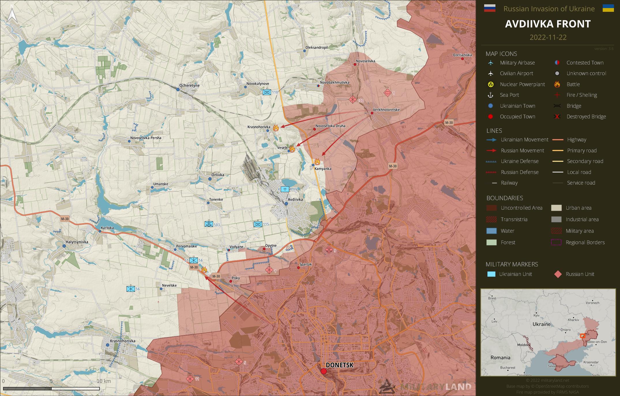
- Russian forces tried to break through Ukrainian lines in the vicinity of Krasnohorivka, Vesele and Kamyanka. Neither attempt was successful.
- Clashes persist in the vicinity of Pervomaiske, the enemy attempts to deeper into the settlement.
Donetsk Front
includes the center and southern part of Donetsk Oblast
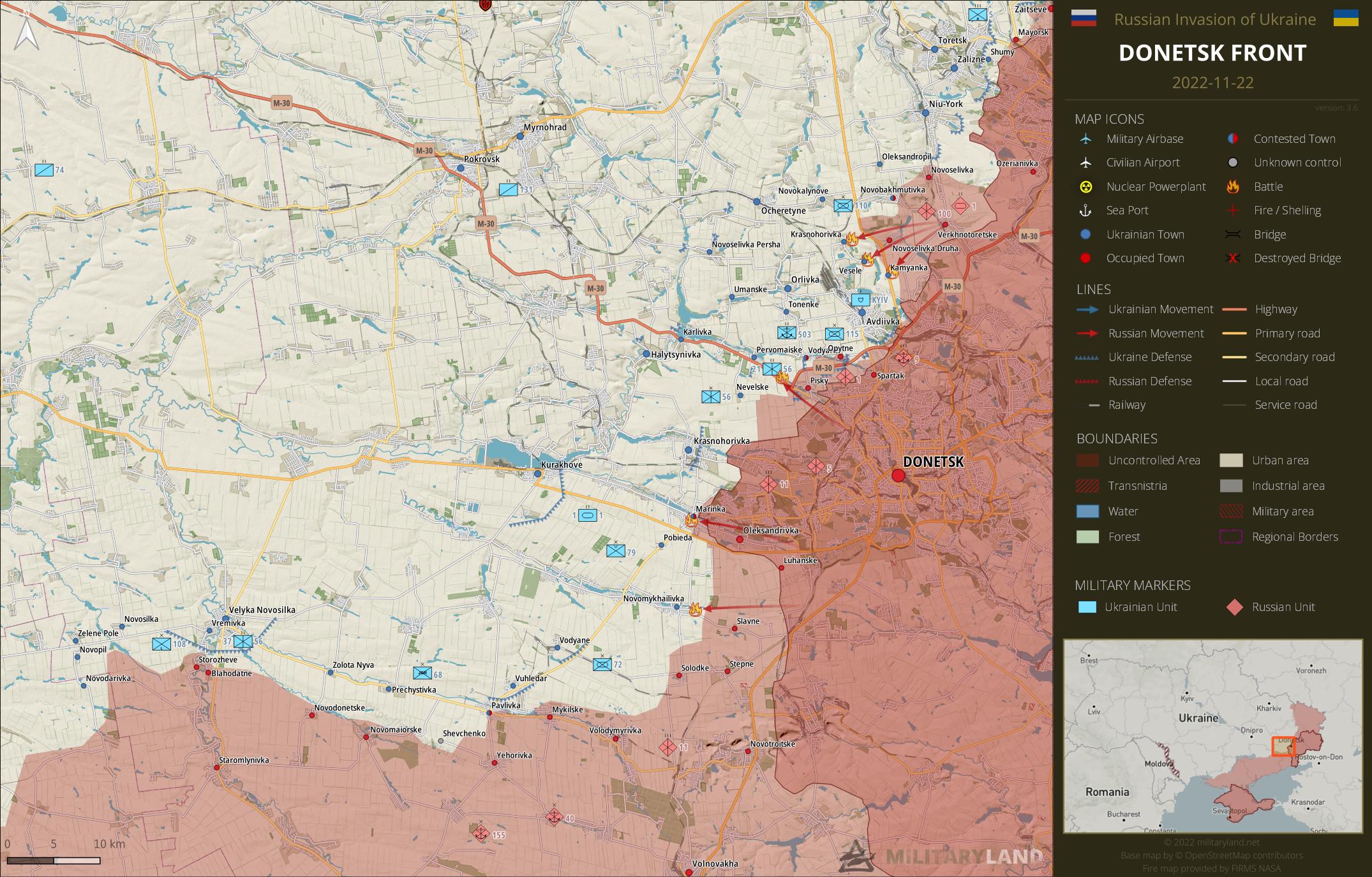
- Heavy clashes are reported from Marinka. Russian forces managed to advance by a few meters towards the center.
- Ukrainian forces repelled a Russian attack in the vicinity of Novomykhailivka.
Zaporizhzhia Front
includes the Zaporizhzhia Oblast
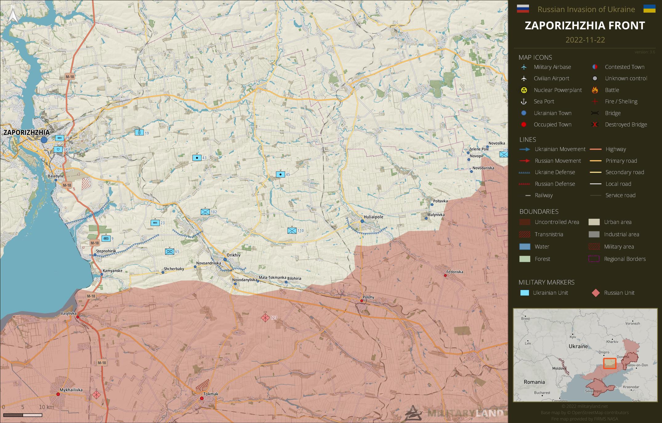
Zaporizhzhia Oblast
- No change on the ground during the past 48 hours.
Kalanchak Front
includes the left bank of Dnipro river south of Kherson and Kakhovka
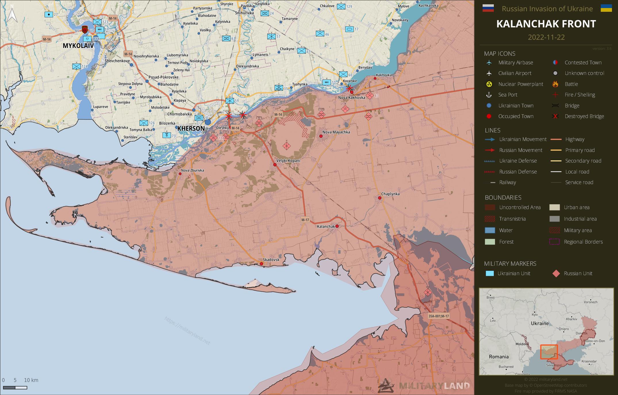
- No change on the ground during the past 48 hours.
Full map
The full overview map of current situation.

Looking for an interactive map? We got you covered. Visit our original Deployment map.
If you would like to use our maps in your project, video or any other media, please visit Invasion maps page for more information.
This summary and detailed maps are based on the following sources:
General Staff of the Armed Forces of Ukraine, official media channels of Ukrainian regional administrations, Ukrainian Ministry of Internal Affairs, Security Service of Ukraine (SBU), geolocated footage and press releases of Russian Armed Forces, self-proclaimed DPR and LPR.
If you enjoy this content, the best way to support our site is by sharing it and following us on X, Bluesky and Facebook.
Topics:
Related posts
Our community
Mentioned Units
No unit mentioned.Support us
Although they are, to date, inexperienced and ill-equipped, the Russian mobilized troops who will join the front in the coming weeks will pose a significant problem to Ukraine. Coupled with the harshness of winter, for the military but perhaps most of all for the civilian population victim of missile strikes, this heralds difficult times for Ukraine in the weeks to come.
I think the priority of the allied forces should be to supply Ukraine with even more missile systems (especially long-range ATACMS) to inflict maximum damage on the Russian mobilised troops, ammo for air defence and anti-drone electrical jamming systems and with electrical generators to save the general population and economy
Russia has also shortened the front considerably. But the harshness of winter will play into Ukraines military hands, they are better equiped for it. We will see when Bezdorizhzhia ends.
I hope the best for Ukraine
Bezdorizhzhia, muddy season slow down.
Frozen ground will come soon in the north east though.
ruSSians how can you be so stupid and EVIL, WAKE UP and get out of Ukraine!
Does anyone have fair grasp on how many soldiers Russia has lost last 2 months, attempting to capture Bakhmut, Avdiivka, and score of villages in Donetsk?
Are we talking about – thousands, or is the number closer to, tens of thousands?
nobody could answer this question with confidence, since it’s a really hard question.
if we go by numbers from ukraine (big pinch of salt needed)
23.September 56k+ KIA
23.November 85k+ KIA
approx. 30k during the last two months
now not all are from donetsk, but the area sees the most of russian pushing, so i’ll just 3/4 it and we’ll have 22,5k KIA in this area.
(this is most likely false)
It’s definitely in the thousands.
About 80,000
In the area of Bakhmut, the Wagner group sent about 10k former prisonners to the front – almost everyone died.In Pavlivlka, Russian elite infantery suffured about 2k causalties in a couple of days. And that’s just the tip of the iceberg.
So the number of russian causaulties shall be in tens of thousands.
That’s quite a bit, had presumed casualties must be terrible – heard of entire units losing, 90% or even near 100%. If they have lost 20-30K in 2 month’s, quite a waste of troops — I like to compare this fruitless attempt by Russia lasting 2 months; as equivalent of Nazi German Battle of the Bulge Dec. 1944. Where Hitler wasted troops, Hitler’s Germany ought rather have used to man defenses.
Standard Russian military tactic weaken your enemy with continued attacks until he has to withdraw due to lack of ammunition or replacements. It’s how they beat Germany back in WW2 just shear numbers not that I think it will work this time.
Won’t work, Russia isn’t USSR – Stalin had the entire population of Central-Asia to throw in, explaining why it must have looked to Nazis, Stalin had inexhaustible supply – Russia hasn’t got Central-Asia any more, RU population is declining. Russia can’t actually thus any more afford that tactic, worse Ukr. has got access to a bigger arsenal. Meaning, time isn’t working with Russia – this time.
How many Ukrainian and Russian soldiers are on the front now?
Hard to know exactly.
Russian all include, probably no more than 500k. Really optimist number.
Ukrain more than 1M defender. Including 200k ? of police and around 400k territorial defense. But not all in fight, since july, Ukrain make rotation and some units have “free time “.
Defensive position are principaly hold by territorial defense.
Most assess Ukr. got round 1 mn. – Ukr. commenced training conscripted and volunteer troops soon after RU launched invasion; appear have completed training round July, evidently since then active, now many even most of those have battle experience. Assessed average Ukr. troop is superior to average RU troop, better average standards of training, and equipment. RU has between 1/3 – 1/2 numbers.
He asked about the frontline. The ukrainian military may be at 1 million, but only like a third of that or even less would be combat troops. I think the usa has a 1 to 2 ratio, ukraines be be higher.
You’re using ratios for peace-time armies, when country is fighting for own existence — ratio of combat troops is certain to be whole-lot higher.
For every soldier on the front line there are at least ten in support roles.