Invasion Day 232 – Summary

The summary of the situation of Russian re-invasion to Ukraine covering the last 48 hours, as of 13th October 2022 – 22:00 (Kyiv time).
Briefly:
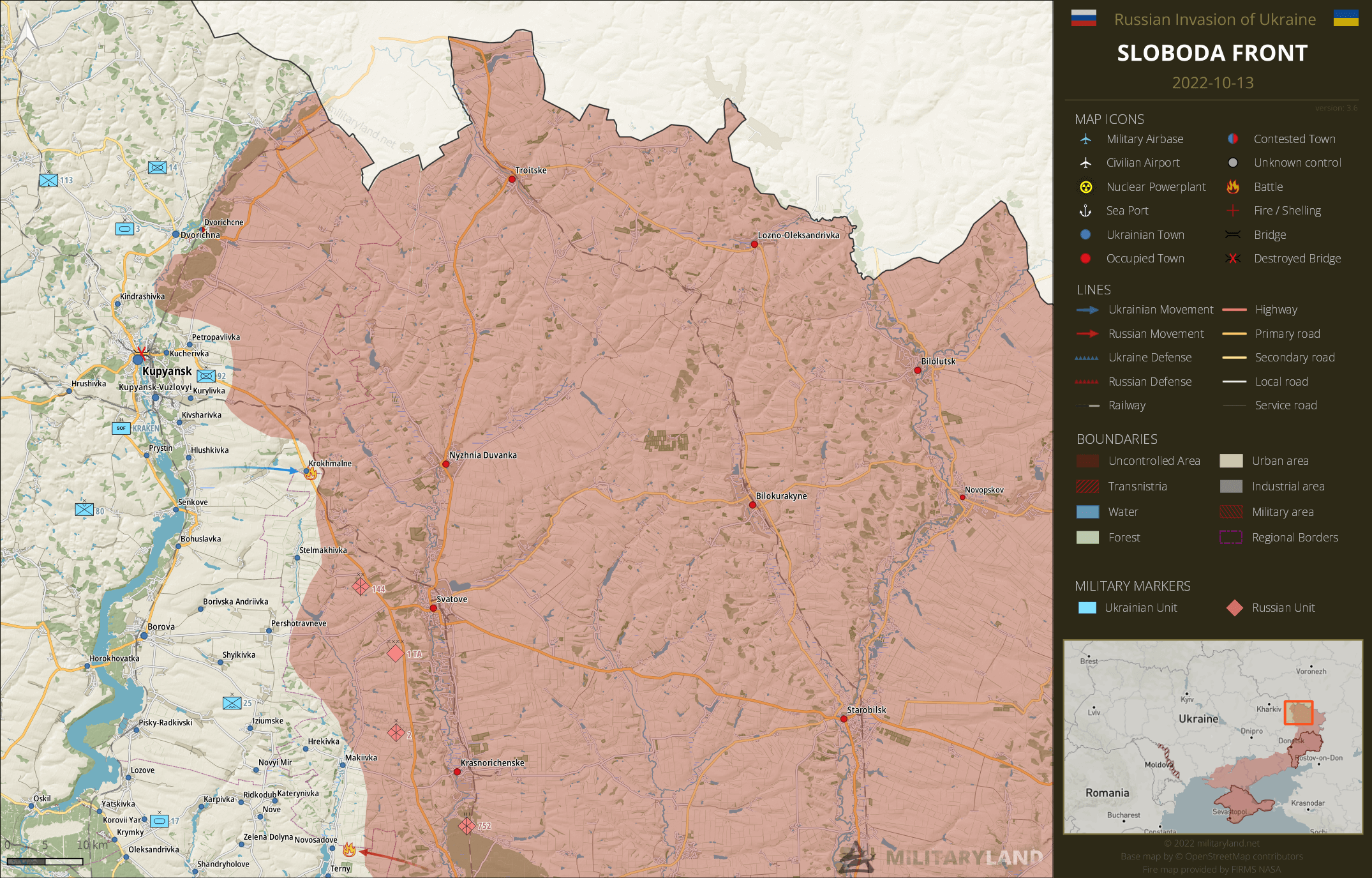
Ukrainian Army liberated a settlement on the border of Kharkiv and Luhansk Oblast and its forces are slowly approaching Svatove from the north-west.
Russian troops remain focused on Bakhmut and its vicinity. The situation ain’t easy, but Ukrainian defenders continue to hold off the enemy as much as they can.
Sloboda Front
includes the area of between Oskil and Aydar river
Svatove direction
- Ukrainian forces liberated Krokhmalne settlement, located on a road connecting Kupyansk and Svatove.
- The enemy attacked Ukrainian positions in the vicinity of Novosadove. The attack was repelled.
Bakhmut Front
includes the vicinity of Bakhmut
- Static fighting persist in Soledar and Bakhmutske. Neither side reported new gains or losses.
- Russian forces remain focused on the southern part of Bakhmut. Ukrainian defenders repulsed Russian attacks in the direction of Ivanhrad and Bakhmut, but the situation is complicated.
- The enemy attempted to break through towards Ozaryanivka, but wasn’t successful.
- Ukrainian defenders repelled a Russian attack towards Mayorsk.
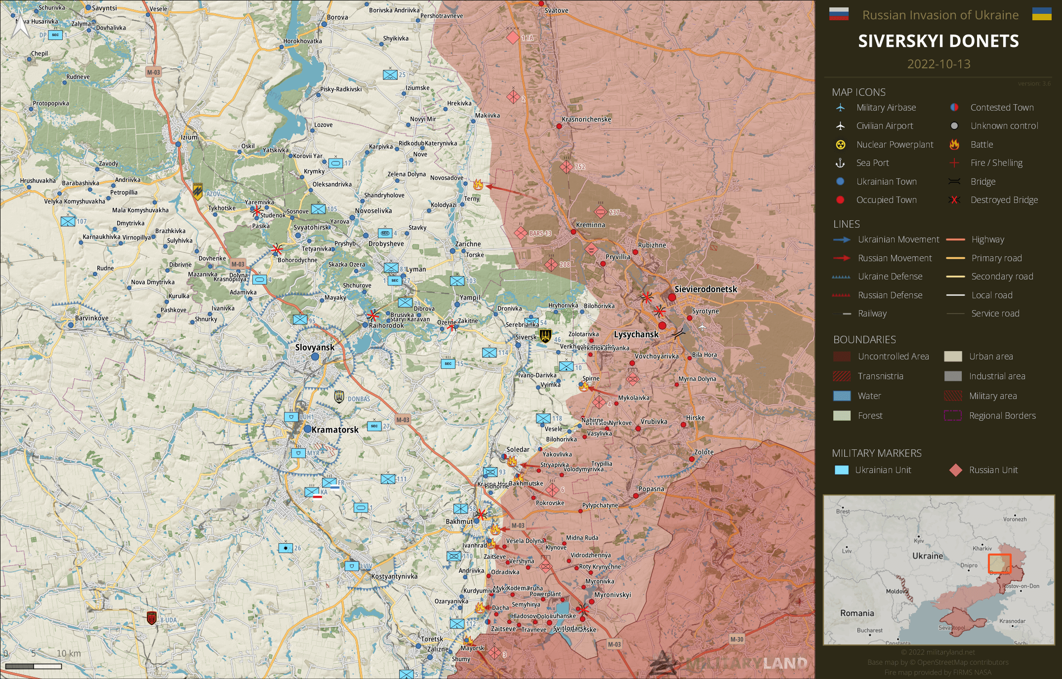
Siverskyi Donets
overview map of Slovyansk, Kramatorsk, Bakhmut and Lysychansk vicinity
- The enemy tried to advance in the vicinity of Spirne settlement, but didn’t have success.
Donetsk Front
includes the center and southern part of Donetsk Oblast
Donetsk Oblast
- Ukrainian troops repelled Russian attacks on both Krasnohorivka settlements, Pervomaiske and Marinka. The enemy reduced the number of attacks after several days of failed attempts to break through Ukrainian lines in this area.
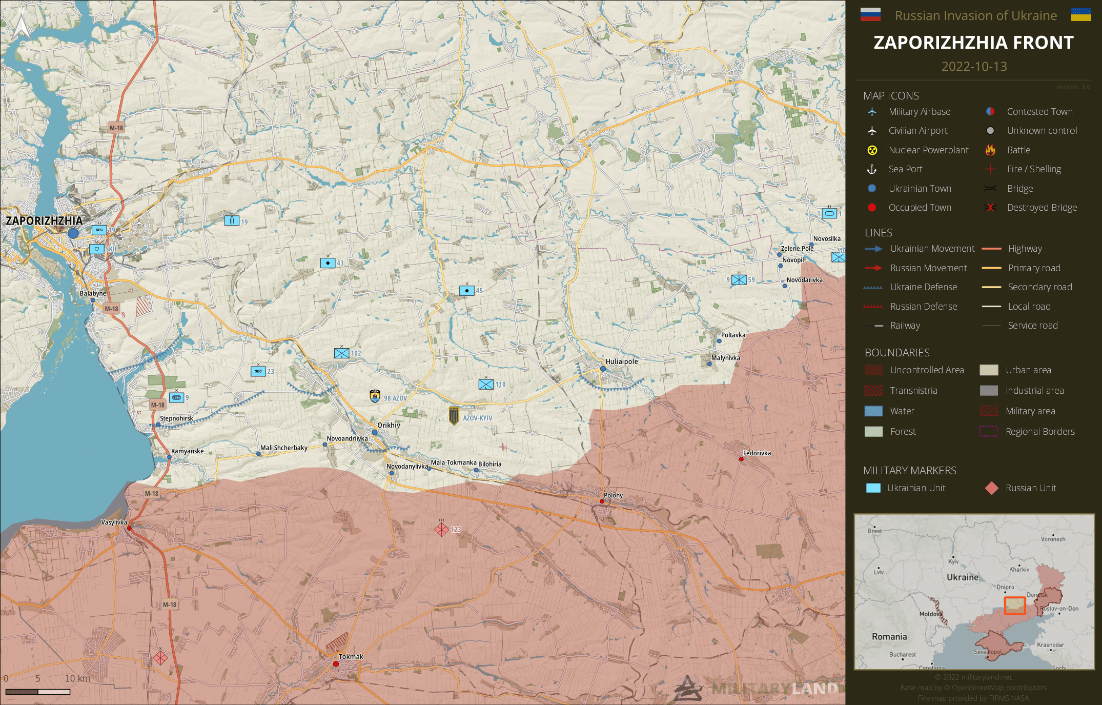
Zaporizhzhia Front
includes the Zaporizhzhia Oblast
Zaporizhzhia Oblast
- No change on the ground during the past 48 hours.
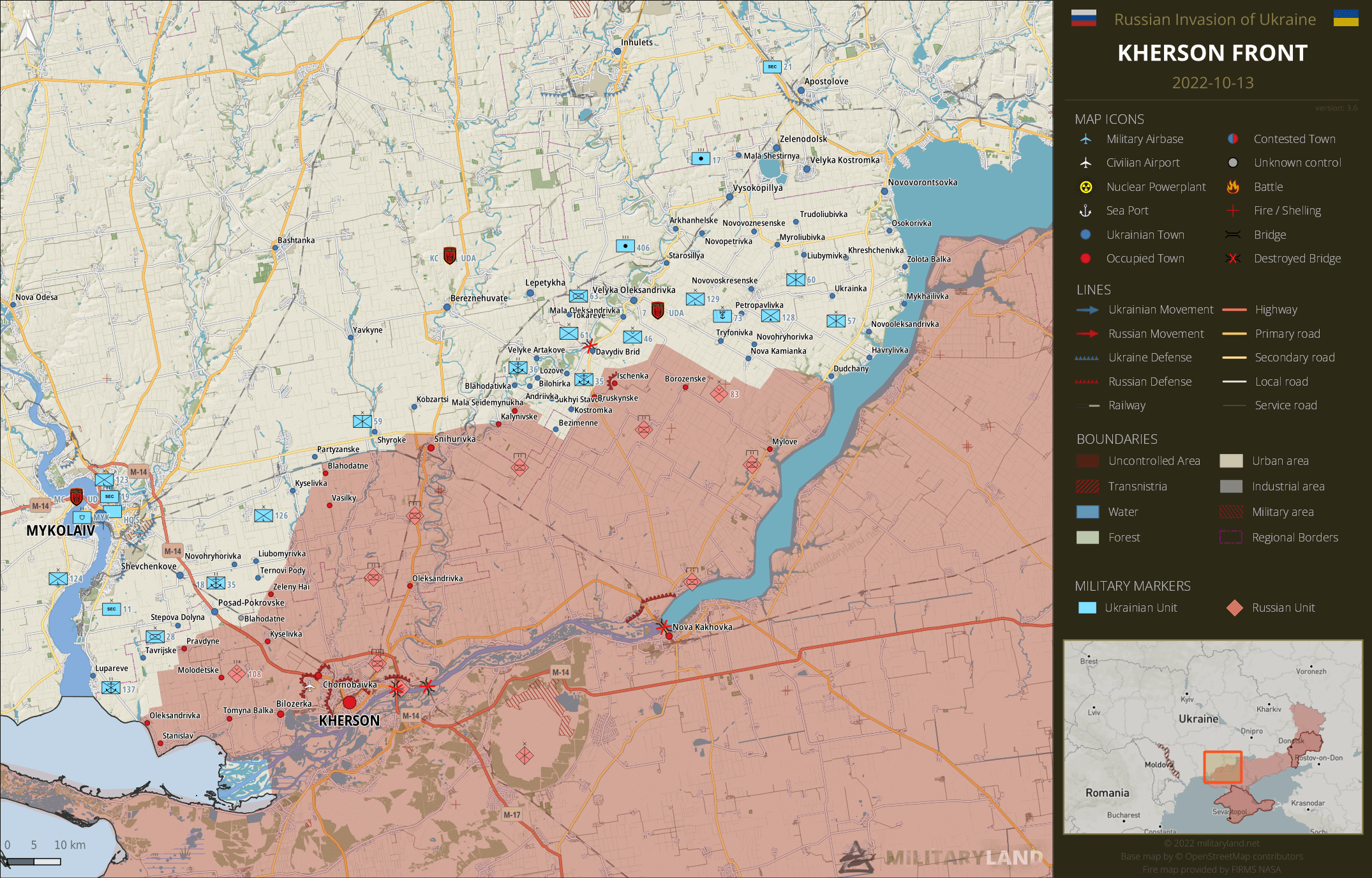
Kherson Front
includes the vicinity of Kherson and Mykolaiv
- No change on the ground during the past 48 hours.
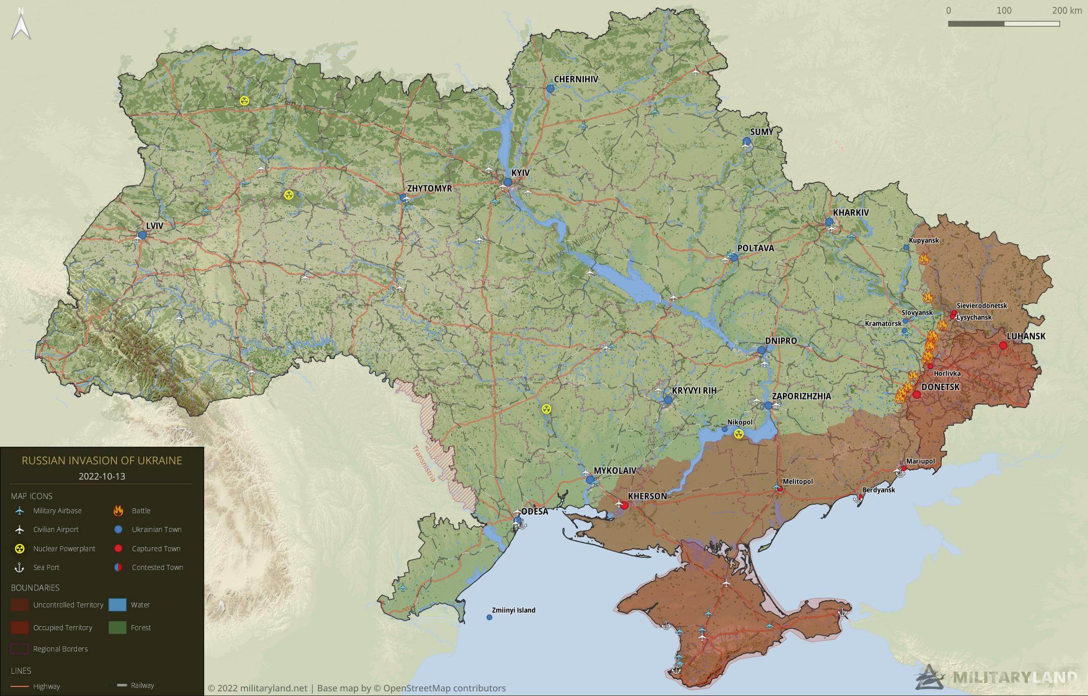
Full map
The full overview map of current situation.
Looking for an interactive map? We got you covered. Visit our original Deployment map.
If you would like to use our maps in your project, video or any other media, please visit Invasion maps page for more information.
This summary and detailed maps are based on the following sources:
General Staff of the Armed Forces of Ukraine, official media channels of Ukrainian regional administrations, Ukrainian Ministry of Internal Affairs, Security Service of Ukraine (SBU), geolocated footage and press releases of Russian Armed Forces, self-proclaimed DPR and LPR.
If you enjoy this content, the best way to support our site is by sharing it and following us on X, Bluesky and Facebook.
Topics:
Related posts
Our community
Mentioned Units
No unit mentioned.Support us





why .png not.jpg?
Probably because png is lossless
It seems Russia in west-Kherson has put the 4,000 airbornes they do have at the front Pervomaiske to Mylove and some marines at the very south and then artillery east of Dnipro protecting the east flank. These held off Ukrainians for 2 weeks
The last Ukrainian gains 50 km Novovorontsovka to Mylove seems to be caused by Russia shifting out 1,500 airbornes for refitted draftee brigade collapsing
good